Sunday, August 29, 2021

Further thoughts on the location of Finn's Glen

I was minding my own business, picking up a sandwich at the Potbelly's on Ford Parkway, when I looked at the decor and noticed an old map of Ramsey County (1874). Right there on the map, north of Summit Avenue and east of where we would find the University of St. Thomas today, is "Wm. Finn". William Finn. Finn of Finn's Glen.

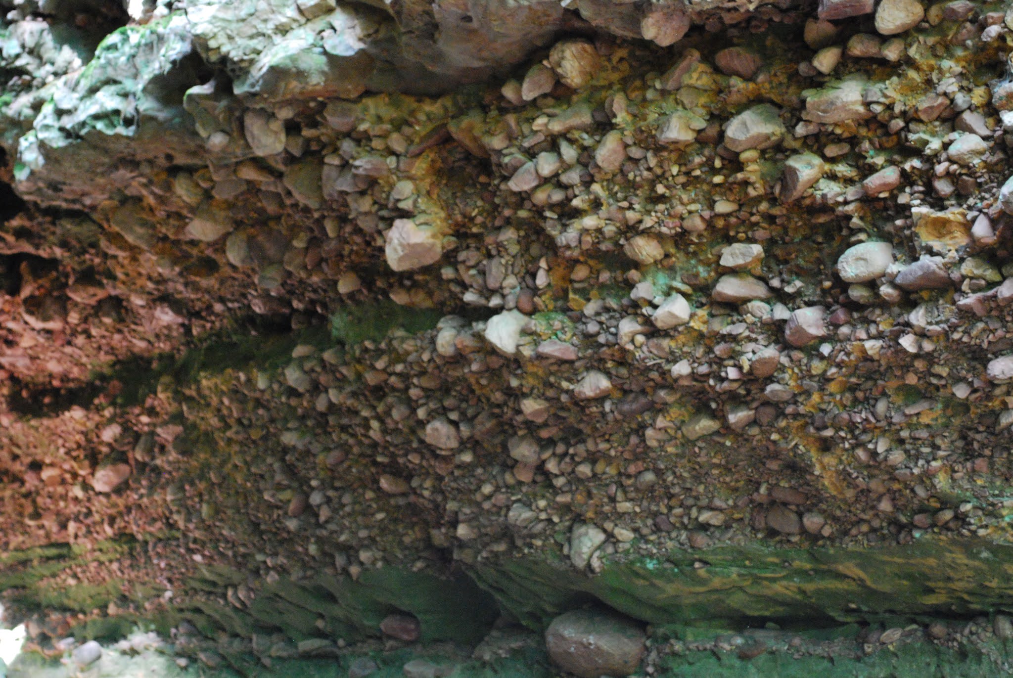
Forgive the flare. It was a dramatic moment.

Bingo. Meaning what, exactly? (Unfortunately, it doesn't identify the glen.) Years ago I wrote about Finn's Glen in conjunction with Shadow Falls. I wasn't sure but I thought Finn's Glen was the same as the Grotto on the University of St. Thomas campus, south of Shadow Falls. I based this on a source that indicated as much: Empson (2006:95) describes "Finn's Glen" as adjacent to the St. Paul Seminary, south of Summit Avenue, and a place of meditation. As a University of St. Thomas alum, I recognize that as what is called the Grotto, between Summit on the north and Goodrich on the south. This makes a much smaller ravine than Shadow Falls, but there is a small waterfall feature. Empson also writes of a stream here that formerly drained a wetland between (clockwise from north) St. Clair, Snelling, Randolph, and Fairview. We can see this in Winchell's "Falls of St. Anthony" map (1877). But...

Finn's Glen is clearly marked...

...Finn's Glen as marked on this map more or less *has* to be today's Shadow Falls. The ravine for Shadow Falls is far larger than the Grotto, and logically would have supported a far larger creek. Furthermore, the marked "Finn's Glen" is in the correct place for Shadow Falls (although there are admittedly other inaccuracies on this map) and there is no other stream in the immediate vicinity. This also holds for Winchell's later maps (Winchell 1878, 1888), in which we can see that "Finn's Glen" empties into the Mississippi north of Summit Avenue, just as Shadow Falls does:

From Winchell (1878).

From Winchell (1888).

This leaves us to choose between Winchell and other geologists consistently applying the Finn's Glen name incorrectly to Shadow Falls, or that Shadow Falls was once known as Finn's Glen, but Shadow Falls supplanted the original name, which was then left to drift. Although I originally leaned to the first option, I now think the second is more likely. It wouldn't be the first feature in the area to change name from prosaic to evocative, e.g., Brown's Falls becoming Minnehaha Falls. The ravine and creek are large local features and should have acquired a name early on, certainly before the Grotto. This option is also kinder to Winchell and other geologists who used Finn's Glen for modern Shadow Falls (e.g., Sardeson and Ulrich). Does it fit with the timeline?

Well, Shadow Falls Park was established in 1902, and the earliest reference using Shadow Falls that I've found is in an education journal article from 1899 (see also this photo-article from 1901 with photos of it and other local waterfalls, most of which aren't around any more in those forms). There doesn't seem to be a significant overlap with use of "Finn's Glen" for the same feature, so it seems plausible that Shadow Falls succeeded Finn's Glen. Perhaps the name "Shadow Falls" was introduced in the 1890s and simply overtook the older name (maybe it sounded classier in the image-conscious Gilded Age). Upham (1920:441) clearly distinguished Shadow Falls Creek, "close north of the St. Paul Seminary," from Finn's Glen "about a mile farther south". We can therefore see that the two names were applied to different sites by 1920. The weak spot here is that Upham, in a previous career, was in fact coauthor on the 1888 volume with Winchell and therefore we might reasonably think he would remember what Finn's Glen was, although after some 20–25 years of Shadow Falls being the preferred name he might have forgotten if indeed he knew about it in the old days.

Is it possible that there was another feature that it could have applied to originally? Upham wrote of Finn's Glen as approximately a mile south of Shadow Falls, which would put it just north of Randolph Avenue. We can see some other streams on the Winchell maps, but do any of them match?

Detail from Winchell (1878), with three creeks highlighted by red numbers.

#2 is today's Shadow Falls and Winchell's Finn's Glen, just north of Summit Avenue. #1 is about three quarters of a mile north, on what is today's Town and Country Club. (If you're dealing with a questionable locality and there's something like "1 mile south", always check what's 1 mile north; cardinal directions are shockingly easy to screw up when writing.) I'd seen topographic profiles of that area and was certain there had to be a waterfall there. Well, there was, but it's been gone a long time. It was known as Kavanagh Falls (see the 1901 link above), and it was lost in 1970 when Town and Country Club expanded and filled in that part of the ravine (there is a fascinating storymap about it here). (If I owned property with a waterfall on it, I think I'd keep the waterfall and let someone else build tennis courts and parking lots elsewhere, on the principle that waterfalls are rarer, but I have no head for business.)

#3 is more of a mystery. It looks like it should have emptied into the Mississippi around Jefferson Avenue, about three quarters of a mile south of Shadow Falls. This is not a mile, but it's not unconscionably off, either. This one is even harder to account for than Kavanagh Falls. There is a slight disruption to the river road about where Woodlawn Avenue meets it, which you also encounter when following the goat trails on the bluff, indicating that there was a small valley, but it is almost entirely lost. Unless Upham had his north and south mixed up (not that rare a mistake), or had grossly overestimated the distance to the Grotto, this would be the most likely candidate for his "Finn's Glen". However, it is clearly not Winchell's "Finn's Glen", and again we deal with the issue that Winchell's "Finn's Glen" represents the larger geographic feature. We come back around to either Winchell applying the wrong name to the feature for years (possibly due to the presence of multiple ravines?), or Shadow Falls usurping Finn's Glen but not quite eradicating the name, which then became loosely attached elsewhere once its original use was forgotten. (Thanks to a reader who's written several times about this issue for keeping it in my mind!)

References

Empson, D. L. 2006. The street where you live: a guide to the place names of St. Paul. University of Minnesota Press, Minneapolis, Minnesota.

Upham, W. 1920. Minnesota geographic names: their origin and historic significance. Collections of the Minnesota Historical Society 17. Minnesota Historical Society, St. Paul, Minnesota.

Winchell, N. H. 1877. The geology of Hennepin County. Minnesota Geological Survey, St. Paul, Minnesota. Annual Report 5:131–201.

Winchell, N. H. 1878. The geology of Ramsey County. Minnesota Geological Survey, St. Paul, Minnesota. Annual Report 6:66–92.

Winchell, N. H. 1888. The geology of Ramsey County. Pages 345–374 in N. H. Winchell and W. Upham. The geology of Minnesota. Minnesota Geological and Natural History Survey, Final Report 2. Johnson, Smith & Harrison, state printers, Minneapolis, Minnesota.

Sunday, August 15, 2021

Your Friends The Titanosaurs: Hamititan xinjiangensis

As far as I'm concerned, 2021 has been relatively quiet for new dinosaurs (great year for ophthalmosaurid ichthyosaurs, though; I might even learn to spell "ophthalmosaurid" correctly the first time through). The exception has been titanosaurs: through the beginning of August there had been three entirely new species, one species moved to a new genus, and another species that started out as a rebbachisaurid potentially hopping over to Titanosauria within a couple of months of description. Hamititan xinjiangensis makes another new addition. It was published this week (Wang et al. 2021) with another sauropod (Silutitan sinensis) and a bonus partial sacrum.

Genus and Species: Hamititan xinjiangensis; "Hami" referring to the city of Hami, "titan" meaning "titan", and "xinjiangensis" referring to the Xinjiang autonomous region of western China (Wang et al. 2021). Together they mean something akin to "Hami titan from Xinjiang".

Citation: Wang, X., K. L. N. Bandeira, R. Qiu, S. Jiang, X. Cheng, Y. Ma, and A. W. A. Kellner. 2021. The first dinosaurs from the Early Cretaceous Hami Pterosaur Fauna, China. Scientific Reports 11:14962. doi:10.1038/s41598-021-94273-7.

Stratigraphy and Geography: H. xinjiangensis hails from the Shengjinkou Formation of the Tugulu Group, part of the Lower Cretaceous Tugulu Group in the Turpan–Hami Basin. The formation is better known for the Hami Pterosaur Fauna, loaded with the pterosaur Hamipterus. The holotype and only known specimen of H. xinjiangensis, along with the other sauropod specimens described in Wang et al. (2021), came from lacustrine sandstone. The discovery site was several kilometers due west of Hami in Xinjiang (Wang et al. 2021).

Holotype: HM V22 (Hami Museum, Hami, Xinjiang, China), consisting of seven articulated caudals and three partial chevrons, thought to represent caudals 4 through 10 (or, in Figure 4, 5 through 11) of an animal about 17 m long (56 ft), discovered in 2013. A small theropod shed tooth was found nearby (Wang et al. 2021).

Figure 4 in Wang et al. (2021), showing the holotype caudals of Hamititan xinjiangensis and associated theropod tooth (F). Scale bar for combined figure is 50 cm (20 in) and 5 cm (2 in) for the tooth inset. See here for full caption. CC BY 4.0.

Is H. xinjiangensis indeed a titanosaur? It's a fair question, given both the historical difficulties surrounding Early Cretaceous titanosaurs and the particular difficulties classifying East Asian Early Cretaceous sauropods, which seem to be doing their own thing. First things first: H. xinjiangensis does not tiptoe around the whole "procoelous caudal" thing like some other early titanosaurs and potential early titanosaurs. It is boldly, proudly procoelous. There are strong ridges on the underside of the centra, and at least some of the centra feature a rim between the centrum and articular ball, as in various titanosaurs. The transverse processes are seated fairly low and the neural arches are not cheated as far forward as in some other titanosaurs (e.g., aeolosaurs). The bones do not feature spongy texture (Wang et al. 2021). Despite some quibbles, it's certainly got more going for it than some other putative early titanosaurs (although I certainly would not be surprised if within a few years someone argued it was not a titanosaur, just another East Asian Early Cretaceous sauropod with a titanosaur-like tail).

Is it Silutitan? Well, we can be reasonably certain that the holotype of H. xinjiangensis is not from the same individual as the holotype of S. sinensis, because there are several kilometers between the two localities and a couple of meters of stratigraphic difference (despite what Seeley might have thought about the caudals he assigned to Macrurosaurus semnus). To look at this phylogenetically, Wang et al. (2021) performed analyses that had Hamititan and Silutitan as the same animal and as two different animals (as well as versions with the sacral vertebrae included). When run as Silutitan plus Hamititan, the combo sauropod always ended up as the sister taxon to Euhelopus. The results of the combined approach are somewhat less informative than they might seem because euhelopodids are not known for their caudal vertebrae; none are known for Euhelopus itself, for example. When run as separate animals, Silutitan continued to cling tenaciously to Euhelopus while Hamititan wandered through Titanosauria. Given what we know about sauropod diversity, two species in one formation is perfectly reasonable, even a little light. (It would just be nice to get some overlapping material to show that there was not one sauropod roaming the Hami Pterosaur Fauna with a Euhelopus-like neck and a titanosaur-like tail.)

References

Wang, X., K. L. N. Bandeira, R. Qiu, S. Jiang, X. Cheng, Y. Ma, and A. W. A. Kellner. 2021. The first dinosaurs from the Early Cretaceous Hami Pterosaur Fauna, China. Scientific Reports 11:14962. doi:10.1038/s41598-021-94273-7.

Sunday, August 8, 2021

Geranosaurus atavus

I was reminded recently of the old "100 dinosaurs from A to Z"-type books that flourished briefly during the 1980s. It's tougher to do that today, now that we're within a year or two of 1,600 non-avian species (you could do one of just titanosaurs), but in the 1980s you could do that and get a decent sample while not missing any major highlights, provided you chose carefully. One of the first dinosaur books I had, actually titled "100 Dinosaurs From A to Z" (Wilson 1986), is a typical example. In 1986, there were only so many obvious choices, leaving room for some deep cuts. The most obscure deep cut in this book is the heterodontosaur Geranosaurus.

Sunday, August 1, 2021

Practical applications of Chesapecten, early 19th century

"Fossil pectens of a large size, some of them ten inches wide, are found abundantly in the lower part of Virginia. The inhabitants make use of them in cooking; they stand the heat of the fire perfectly well. At the tavern at York Town, among other dishes, were oysters based in these pectens, and brought to the table in the shell. I wanted the company of a few scientific friends to enjoy the treat. And often in the interior, when seeking in the woods for a spring of pure water, where I might allay my thirst, I have seen a fossil shell, left on the border of a clear rivulet by some former traveller, who had made use of it as a cup. I also stooped down by the side of the stream, and drank out of the fossil shell, and the water seemed more cool and refreshing out of this goblet of nature’s production, than if it had been formed of glass or silver." (Finch 1833)

Chesapecten madisonius, not quite as famous as C. jeffersonius but still quite nice.

References

Finch, J. 1833. Travels in the United States of America and Canada. Longman, Rees, Orme, Brown, Green, and Longman, London, United Kingdom.

Sunday, July 18, 2021

A fossiliferous Prairie du Chien block

The Prairie du Chien Group is great for stromatolites, but not much for other fossils except for localized occurrences of molds and casts of mollusks; see for example the second photo here or the second photo here. You do get lucky occasionally, though. I did not collect the following block myself, nor was it found in situ, but I would be very, very surprised if it did not originate in the Prairie du Chien Group. The most notable aspect about it is this spiral feature:

What is it? A few thoughts:

If you had to pick a second group to find in the Prairie du Chien after stromatolites, it would be snails, and the Prairie du Chien snails do include some large forms that are flat-coiled or coiled in a low spiral, such as Helicotoma and Rhachopea. They're even of comparable size to this.

Some trace fossils spiral, but we can see that the width of the spiral passage increases as it goes out, and animals do not generally increase in girth like that over a short distance unless they handle matter like the Incredible Hulk, so that's not what we have.

Finally, although we usually think of early Paleozoic nautiloids as straight-shelled, there were a few coiled forms, including one known from the Prairie du Chien: Eurystomites. We can see that this spiral seems to separate from the inner coil near the end, and conveniently enough, Eurystomites also gets lax at the end of its coil. However, there's no clear indication of chambers.

What do I think? Without being able to see the entire fossil, you could make an argument that this is an internal cast (steinkern) or external cast of a snail (in which the outer whorl shows separation either because we're looking at the inside or because the plane of exposure isn't low enough to show that the whorl is actually just flaring), or a poor-quality external cast of a Eurystomites or similar nautiloid (can't be internal, because there's no evidence of chambers).

Operating on the principle that where you find one body fossil in the Prairie du Chien, you might find more, I examined the rest of the block, which turned out to have several more easily interpreted molds of much smaller and more obvious snails:

Low-coiled snail, coiling into the block.

A more elongate form; the shell may be slightly sculptured, but relatively coarse mineralization in the mold makes it hard to tell. A similar but less easily photographed example looked much smoother.

A pair of shell molds exposed at an awkward angle.

Sunday, July 11, 2021

The Short Life and Unnecessary Death of the Devils Lake Formation

Edward Oscar Ulrich was previously featured here as one of the main players in the brachiopod noir "The Great Brachiopod Caper of 1892", on the side of the "victors". Decades later, though, he seems to have come out on the short end with a formation he named from one of the more geologically notable areas in Wisconsin: Devil's Lake in the Baraboo Range. Devil's Lake itself is more than worthy of a post in its own right, but for the moment I'll just plant that seed for future reference.

A brief bit of exposition is in order, though. The Baraboo Range is an exhumed area of early Paleozoic topography, with a core of Proterozoic Baraboo Quartzite. The range is elliptical and oriented east-west, with a north range and a more complete south range; during the Cambrian and Early Ordovician, before it was buried, the range was oriented north-south instead of east-west. Similar to Taylors Falls, where basalt withstood the advancing seas, the ancient quartzite of the Baraboo Range formed islands in the Cambrian sea. Also like Taylors Falls, there is a conglomeratic sandstone that formed adjacent to the resistant Precambrian rocks, only in this case the conglomerate is composed of material shed from Baraboo Quartzite rather than Midcontinent Rift basalt. It is this flanking sedimentary unit, well-exposed near Devil's Lake, that Ulrich named the Devils Lake Formation.

The Devils Lake Formation first popped up in Ulrich (1920), as a name in a table. It did not get a proper description until Thwaites (1923), where it was described as a "more or less glauconitic sandstone" with quartzite pebble conglomerate. Ulrich (1924) added a little more, emphasizing the well-developed conglomerate found on the flanks of the quartzite ridges and noting its presence in nearby Parfrey's Glen. Never the subject of much discussion, the Devils Lake Formation was laid to rest in the literature following Wanenmacher et al. (1934). The authors regarded the formation as a geological chimera, because it was not coherent in terms of biostratigraphy. (It was also mixed up in Ulrich's doomed effort to establish the Ozarkian and Canadian periods between the Cambrian and Ordovician, which didn't help its reputation.) In light of the push to define formations by their rocks rather than their fossils that came about not long after Wanenmacher et al. (1934), this is a fatally flawed argument: formations live or die on the distinctiveness of their lithology, not because of how many trilobite zones they span. The Devils Lake Formation should have been expected to span multiple zones, because it represents unusual depositional conditions that persisted adjacent to the range beginning with the arrival of the Cambrian seas until the range was buried during the Ordovician. However, going back and resurrecting the Devils Lake Formation was not a high priority for anyone.

The plot thickened when in 1990 Clayton and Attig named a new formation, the Parfreys Glen Formation, for quartzite conglomerate and conglomeratic sandstone found adjacent to the quartzite ridges of the Baraboo Range. The new unit encompasses the same kinds of rocks as the Devils Lake Formation and is present in the same areas. It is hard to avoid the conclusion that the Parfreys Glen Formation is the Devils Lake Formation under a new name. Oddly, even though all of the papers mentioned above are referenced several times in the 1990 publication, nowhere is the term "Devils Lake Formation" used, not even to dismiss it. (This is not the only example of something about Devil's Lake geology going missing; for some reason the Cambrian fossils found near the lake are basically absent from the literature since Resser 1942. For a further "devilish" aspect, no two geologic maps of the area map the Cambrian rocks in exactly the same places around the lake; compare Wanenmacher 1932 [in Raasch 1935], Dalziel and Dott 1970, Clayton and Attig 1990, Baumann and Abrams 2013, and Stewart and Stewart 2021.)

Conglomerate in Parfrey's Glen; is it the Parfreys Glen Formation, or the Devils Lake Formation in disguise? Found on Wikimedia Commons, taken by user Wackybadger. CC BY-SA 3.0.

References

Baumann, S. D. J., and M. J. Abrams. Geologic map of Devils Lake, Sauk County, Wisconsin, United States, T11N R6E and R7E. Midwest Institute of Geosciences and Engineering, Chicago, Illinois. Publication M-072013-1A. Scale 1:12,000.

Clayton, L. and J. W. Attig. 1990. Geology of Sauk County, Wisconsin; with a section about the Precambrian geology by B. A. Brown and an appendix naming the Rountree Formation by J. C. Knox, D. S. Leigh, and T. A. Frolking. Wisconsin Geological and Natural History Survey, Madison, Wisconsin. Information Circular 67. Including geologic map, scale 1:100,000.

Dalziel, I. W. D., and R. H. Dott, Jr. 1970. Geology of the Baraboo District, Wisconsin: a description and field guide incorporating structural analysis of the Precambrian rocks and sedimentologic studies of the Paleozoic strata. Wisconsin Geological and Natural History Survey, Madison, Wisconsin. Information Circular 14. Scale 1:62,500.

Raasch, G. O. 1935. Paleozoic strata of the Baraboo area. Kansas Geological Society, 9th Annual Field Conference Guidebook:405–415.

Resser, C. E. 1942. Fifth contribution to nomenclature of Cambrian fossils. Smithsonian Miscellaneous Collections 101(15).

Stewart, E. K., and E. D. Stewart. 2021. Geologic map of the Baraboo 7.5-minute quadrangle, Sauk County, Wisconsin. Wisconsin Geological and Natural History Survey, Madison, Wisconsin. Open-File Report 2021-02. Scale 1:24,000.

Thwaites, F. T. 1923. The Paleozoic rocks found in deep wells in Wisconsin and northern Illinois. The Journal of Geology 31(7):529–555.

Ulrich, E. O. 1920. Major causes of land and sea oscillations. Journal of the Washington Academy of Sciences 10(3):57–78.

Ulrich, E. O. 1924. Notes on new names in table of formations and on physical evidence of breaks between Paleozoic systems in Wisconsin. Transactions of the Wisconsin Academy of Sciences, Arts and Letters 21:71–107.

Wanenmacher, J. M. 1932. The Paleozoic strata of the Baraboo area, Wisconsin. Dissertation. University of Wisconsin, Madison, Wisconsin.

Wanenmacher, J. M., W. H. Twenhofel, and G. O. Raasch. 1934. The Paleozoic strata of the Baraboo area, Wisconsin. American Journal of Science (5th series) 28(163):1–30.

Sunday, July 4, 2021

Fossil Crocodylomorphs of the National Park Service

For this year's National Park Service fossil group inventory, I've chosen crocodylomorphs, which for convenience I'm going to refer to as "crocs". Crocodylomorpha encompasses the true crocodilians and their closest extinct relatives, which over the years has been defined to exclude major groups of allied Triassic archosaurs (rauisuchids, poposaurs, prestosuchids, etc.). (Technically speaking, traditional Crocodilia is closer to the clade Crocodyliformes, but I have a soft spot for "sphenosuchians" and it's my blog.) Non-crocodilian crocodylomorphs were big players throughout the Mesozoic but came to peter out in the Cenozoic, with holdouts into the Miocene (Sebecosuchia). Some of these non-crocodilian crocodylomorphs looked basically like modern crocodilians and presumably filled very similar niches, but by definition weren't crocodilians*. Others were quite a bit different; for example, small, long-legged terrestrial crocs had a wide distribution from the Late Triassic through the Jurassic, and there were multiple groups of marine forms.

*I have certain misgivings about crown groups, particularly that future stability of usage relies on groups not going extinct (or there would have to be backdating, like radiocarbon dates are pegged to 1950), although at this point I might as well complain about the decline in use of Etruscan.

The NPS record of croc fossils turns out to be sparser than I expected: there are 17 park units with solid records (albeit two of these being reworked or washed up, making them hard to place stratigraphically), and another couple potential records. Here is the requisite map and its accompanying long caption:

Click to embiggen. The sites mentioned in this post are: 1. John Day Fossil Beds National Monument; 2. Bighorn Canyon National Recreation Area; 3. Fossil Butte NM; 4. Dinosaur NM; 5. Colorado NM; 6. Curecanti NRA; 7. Bryce Canyon National Park; 8. Glen Canyon NRA; 9. Petrified Forest NP; 10. Chaco Culture National Historical Park; 11. Theodore Roosevelt NP; 12. Badlands NP; 13. Agate Fossil Beds NM; 14. Niobrara National Scenic River; 15. Big Bend NP; 16. Waco Mammoth NM; 17. Gateway NRA; 18. Fort Washington Park; 19. Cumberland Island National Seashore.

These 19 units are primarily in the Colorado Plateau and northern Great Plain, and these two areas correlate in large part to temporal distribution: the Colorado Plateau records are mostly Jurassic and Cretaceous, and the Great Plains records are Cenozoic. A couple of compact diagrams will show this:

Part 1 shows the Mesozoic, Paleocene, and Eocene records, which make up the bulk of the reports.

Part 2 shows the few younger records; the two that can't be pinned down are added to keep them company.

You can probably guess a lot of the story if you have some familiarity with the stratigraphy of western North America. As so many other groups of terrestrial vertebrates, the place to go in the NPS for Triassic crocs is Petrified Forest National Park, where "sphenosuchians" have been found in the famous Chinle Formation. (Ignore the phytosaurs; they only look like crocs.) After that, possible early croc tracks have been found in the Navajo Sandstone of Glen Canyon National Recreation Area; with all of the Early Jurassic tracks in the Colorado Plateau parks, there are likely other track records. We have no body fossil records in the parks' rocks yet, though (the facies aren't as forgiving as elsewhere). Four parks have records for the Late Jurassic: Bighorn Canyon National Recreation Area has swim traces attributed to crocs in the Sundance Formation, and no points for guessing what's represented at the other three. (It's the Morrison Formation.) NPS Morrison crocs are best known from Dinosaur National Monument, which primarily has the well-represented Amphicotylus (formerly Goniopholis), but also produced the type specimen of the diminutive Hoplosuchus kayi.

The Cretaceous is more sparsely represented, with nothing confirmed from the Early Cretaceous. Ot the Late Cretaceous records, neither Bryce Canyon NP (Straight Cliffs and Wahweap microvertebrate remains) nor Chaco Culture National Historical Park (Menefee isolated material) have much to speak of. Big Bend NP, on the other hand, has the most impressive croc record in the NPS. Granted, that's an easy call when you can point to the type specimen of the suitably Texas-sized Phobosuchus riograndensis (now a species of Deinosuchus), but the park also has by far the longest record of crocs in the NPS. Five formations are represented: the Aguja Formation and Javelina Formation, both Late Cretaceous; the overlying Black Peaks Formation, which straddles the Cretaceous and Paleocene; the Early Eocene Hannold Hill Formation; and the Middle Eocene Canoe Formation. Recently a second croc species has been named from Big Bend NP fossils: Bottosaurus fustidens, from the Paleocene part of the Black Peaks Formation. Other taxa are present, but have not been studied in as much detail.

Looking elsewhere in the Paleocene, there is a single record of a partial bone from the Aquia Formation at Fort Washington Park, and Theodore Roosevelt NP has crocs in the Bullion Creek and Sentinel Butte Formations, comparable to nearby Wannagan Creek (only not quite so concentrated). The Eocene is fairly good for NPS crocs. Apart from Big Bend, we have croc fossils in: the Wasatch Formation at Fossil Butte NM; the Clarno Formation at John Day Fossil Beds NM; and the Chadron Formation at Badlands NP. The type specimen of Caimanoidea visheri (now considered a synonym of Alligator prenasalis) may have come from Badlands NP.

And that's almost the end. Crocs disappeared from the drying interior of North America during the middle Cenozoic. For the Miocene, we have one *very* sketchy potential record from the early Miocene Anderson Ranch Formation of Agate Fossil Beds NM and better records of crocs from the middle Miocene Valentine Formation of Niobrara National Scenic River (including the type specimen of Nordenosaurus magnus, originally described as a big lizard but now identified as a small crocodilian). At Waco Mammoth NM there is late Pleistocene alligator material, but we are otherwise lacking Pleistocene crocodilian records. Two units have material of uncertain provenance: a scute found in dredge material at Cumberland Island National Seashore and various croc fossils that have washed up at Gateway NRA.