Back in the fall of 2021, I made a work visit to Mojave National Preserve, located logically enough within the Mojave Desert of southern California. While there, I had the opportunity to tour Mitchell Caverns. Mitchell Caverns is in the unusual position of being part of a state land parcel (Mitchell Caverns Natural Preserve or State Natural Preserve, depending on the source), entirely surrounded by another parcel of state land (Providence Mountains State Recreation Area), which is itself surrounded by a National Park Service unit (Mojave National Preserve). For good measure, the cave system is also a National Natural Landmark. It's parks all the way down in the Providence Mountains. (To be fair, the natural preserve designation is kind of a map artifact; it's not really distinct from the state recreation area.)

|
|
A view to the east-southeast from the approach to the caverns. |
The caves of Mitchell Caverns had been known long before they got the name; the two major entrances were known to the Chemehuevi as the "eyes of the mountain" for reasons that are obvious upon approach. The caves were operated as show caves by Jack and Ida Mitchell from the mid-1930s into the mid-1950s.

|
|
The eyes of the mountain. |
Southern California is a land of many mountain ranges. Some have cores of
metamorphic rocks, often Precambrian in age. Others are igneous at heart,
forming from volcanic eruptions or massive intrusions. Still others are ranges
of Paleozoic sedimentary rocks. The Providence Mountains are a composite, but
a respectable part of the spine comes from a durable Pennsylvanian–Permian marine unit
known as the Bird Spring Formation. It's roughly equivalent in age to the Supai Group
at the Grand Canyon (most of the thick red-bed sequence between the Redwall
Limestone cliffs below and the light-colored resistant Coconino Sandstone above). The area
now occupied by the Mojave Desert and Death Valley was then a shallow marine
shelf teeming with life. Of course, once you add some uplift and erosion,
former marine carbonates are great places for caves.
Naturally enough, if you visit, you might spot fossils in the Bird Spring, on your approach or in the caverns themselves. Don't be thinking big showy things, though; it's more like crinoid columnals, corals, and fusulinid foraminifera.

|
|
Here we have a short stack of columnals plus various and sundry tiny
fossil bits. The elliptical light gray things a few mm long are
fusulinids. |

|
|
From the bottom of the sea to the inside of a cave: be a fossil, see the
world. |
There are also more recent fossils. Ancient packrat middens (as well as more recent models, some equipped with living packrats) can be seen, and a sloth humerus was recovered from one of the chambers back in the day.

|
|
A somewhat blurry picture of genuine amberat. Incidentally, anywhere you
see a crevice or crack in the rocks at Mojave National Preserve, you're
liable to see where a packrat has taken up shop. |
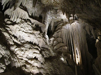
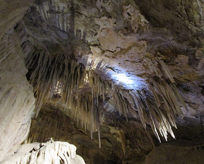
Finally, we come to the part where I get to show neat cave photos (but not too
many, or you might think you've seen everything!):
References
Stone, P., D. M. Miller, C. H. Stevens, J. Rosario, J. A. Vazquez, E. Wan, S. S. Priest, and Z. C. Valin. 2017. Geologic map of the Providence Mountains in parts of the Fountain Peak and adjacent 7.5’ quadrangles, San Bernardino County, California. U.S. Geological Survey, Reston, Virginia. Scientific Investigations Map 3376. Scale 1:24,000.


No comments:
Post a Comment