Showing posts with label locations. Show all posts

Sunday, February 12, 2023

Hunting the wild stromatolite at Vermillion Falls

The gorge at Vermillion Falls, as seen before, is cut through quite a bit of the Prairie du Chien Group. Therefore, it is entirely reasonable to suppose that somewhere in all of those oodles of outcrop, there are some stromatolites. It should be just a matter of walking down and having a look, right? We-e-ll, easier said than done. A few factors are pushing against going from "predicted" to "established":

1) The classic booby prize of vertical exposures—sure, there's a lot of surface, but you don't get to see most of it up-close;

1b) Furthermore, for many of the places where you *can* examine the walls, you can't change your vantage point because backing up a foot or two puts you a foot or two lower or in open space (and that never helps). What makes this annoying with stromatolites is they can be expressed in various scales, and what you can't see with your nose on the rocks may be perfectly apparent from a couple of arm's lengths away except for that whole "absence of footing" thing, or a promising feature may disappear as you clamber up the slope to inspect it;

2) The surfaces have been fried to a crisp by weathering, which for our purposes disguises the fine layering and other subtle features.

The existing literature is not especially illustrative. Stauffer and Thiel (1941) included a section taken at the railroad bridge (now a footbridge), which describes the walls as 58.5 ft (17.8 m) of Shakopee Dolomite over 1 ft (0.3 m) of Root Valley Sandstone over 47 ft (14 m) of Oneota Dolomite, with nary a stromatolite mentioned (to be fair, the lithological descriptions are also very slim). The site has made it into a few theses and other student papers (Shea 1960; Squillace 1979; Robins 2005), but that seems to be about it. Maybe this limited documentation is a recognition of the above limitations by wiser heads than mine, but I have the faith of a gambler that something will turn up if I look long enough, so down we go back into the gorge.

Besides, why would I want to sit around inside when I could see things like this?

My strategy involves *not* looking directly for stromatolites, at least not the classic laminated features. I would never see them here except on fresh breaks. Instead, I'm looking for a couple of other features: bedding planes that are undulating rather than horizontal, and anomalously recessive intervals (I've seen elsewhere that stromatolitic intervals may be relatively erosion-prone compared to non-stromatolitic intervals). These two features should be visible even through the stain of weathering that began before the most recent Ice Age.

Down near the falls, in some of the lowest accessible beds, something very promising is apparent.

Left

Center

Right

We've definitely got an undulating surface that is appropriately stromatiform* in appearance, as well as being within an interval that is recessed. (In fact, the interval above is recessed in comparison to the interval above that, so this is not for people who don't like rocks poised above their heads [or, for that matter, people who have a phobia of birds pooping on them, because there are pigeons roosting in cavities above].)

*Google says it can come up with about 328,000 hits for "stromatiform". What it doesn't tell you is how many are useful and how many are just dictionaries, rhyming words, anagrams, pronunciations, and SEO things seeking to boost traffic with lists from dictionaries.

A little closer, between two apparent mounds

So stromatiform...

Obviously the next thing to do is to is to get close and look for finer details. That's where things become less clear. There are, conveniently, some fresh surfaces (not made by me!), and they do show alternating compositions. They are, however, rather thick layers.

Layers in one fresh surface.

Not quite as fresh, but you get the idea.

Layers on a spalled piece, frozen to the underlying moss.

I'd been hoping to find nice stacks of small columns beneath the undulating layers, but they aren't appearing (yet, at least). If we compare to Logan et al. (1964) and May et al. (2012), the latter also dealing with large Prairie du Chien stromatolites, it's as if we've skipped the columnar "Cryptozoon" stage and gone straight to broad "Collenia". This may say something about the local environment, or it may say that I'm just getting excited about some inorganic stromatiform-producing process.

Then there's whatever the heck is this. Bedded sedimentary rocks don't do things like this without a good reason.

If the issue is not immediately apparent, check the annotated version below and click to expand as necessary.

Too bad it was on the other side of the gorge. There's probably a way down somewhere...

References

Logan, B.W., R. Rezak, and R. N. Ginsburg. 1964. Classification and environmental significance of algal stromatolites. The Journal of Geology 72(1):68-83.

May, S. L., L. E. Davis, and D. G. Brown. 2012. Algal stromatolites in the Willow River Member of the Lower Ordovician Shakopee Formation near Chatfield, Minnesota, USA. The Compass: Earth Science Journal of Sigma Gamma Epsilon 84(1, Article 6):42–48.

Robins, C. 2005. The geology of the New Richmond Sandstone. Senior Integrative Exercise. Carleton College, Northfield, Minnesota.

Shea, J. H. 1960. Stratigraphy of the Lower Ordovician New Richmond Sandstone in the Upper Mississippi Valley. Thesis. University of Wisconsin, Madison, Wisconsin.

Squillace, P. J. 1979. The geology of the New Richmond Member of the Shakopee Formation (Lower Ordovician), Upper Mississippi Valley. Thesis. University of Minnesota, Minneapolis, Minnesota.

Stauffer, C. R., and G. A. Thiel. 1941. The Paleozoic and related rocks of southeastern Minnesota. Bulletin 29. Minnesota Geological Survey, St. Paul, Minnesota.

Saturday, November 27, 2021

The green rocks of home revisited (now with stromatolites!)

Almost exactly five years ago I posted on a visit to Cottage Grove Ravine Regional Park. I was in the area and thought I'd stop again. There's been a lot of work at the park since then, and I wanted to check that the abandoned stream channel and dry waterfall were still visible. Also, over the past five years I've become much better at finding stromatolites, so I thought I'd try my luck.

Were the landforms still there?

That's a dry waterfall, all right. The lowest interval seems to have some weathered cross-bedding; perhaps a somewhat sandier bed in the Prairie du Chien?

I'd say yes, the old channel is still there.

How about stromatolites?

We have stromatolites!

That's the stuff.

Separation has occurred within a stromatolitic interval here.

At the beginning, I was seeing them in loose blocks, which led to the question "where are they coming from?" This was more complicated. The stromatolitic blocks were much lighter-colored and less weathered, indicating fresh faces. There were no obvious fresh faces on the surrounding walls, though. Had large stromatolitic blocks broken up in the dry stream bed fairly recently? Or were these "plants", Prairie du Chien blocks that had been brought in for landscaping and culvert riprap, then declared surplus and deposited here? The walls were not helping.

Features like the wavy lines give a general biotic impression, but I'd really want to see some light-colored patches indicating fallen blocks to cinch a relationship.

Fine lines are visible behind the dull gray and moss.

Then I saw this enormous fallen block.

Do you see them? They're near center. If not, hold on.

There they were.

How about now?

A proverbial bull's eye.

This block is too large and too well-mossed to have been placed here in the past few years. Clearly at least some of the stromatolites are local. I'm still wondering where the loose "clean" blocks came from, though.

Sunday, October 31, 2021

Barn Bluff

One of the outstanding geological sites in southeastern Minnesota is Barn Bluff (He Mni Can to the Dakota, La Grange to the early French explorers*) in Red Wing. The bluff is a bedrock island oriented roughly east–west, adjacent to the Mississippi River just above the Lake Pepin section. If you were to have gone back to the early postglacial period, it would have been a literal island thanks to meltwater filling the Mississippi River valley.

*All of the names are kind of prosaic, actually. "He Mni Can" is "hill, water, wood", "La Grange" or "Lagrange" is "the barn" for its general shape, and the English name is just a translation of the French.

The view of the south side of the west end. Observant eyes may notice that the color of the lower outcrops change near the left side of the picture, from orangish on the left to banded green on the right. Read on for why!

Sunday, January 24, 2021

Vermillion Falls

As the old story goes, when you visit a place, you go to all the sights, but if you live there, you never get around to seeing them. I decided to play the tourist and see Vermillion Falls in Hastings, which I'd never done despite living about 10 to 15 minutes away most of my life. (And yes, it's spelled with two "l"s here.)

Partly frozen over, with adjoining industrial facility at the falls itself.

Looking down into the gorge from above the falls.

Vermillion Falls is a waterfall on the Vermillion River, a tributary to the Mississippi. The falls and downstream gorge are actually not unlike a miniature version of the Mississippi gorge from Fort Snelling up to St. Anthony Falls. Aside from scale, the major difference is the steeper walls. Unlike the Mississippi, which has only had to contend with about 15 to 30 feet (5 to 10 m) of Platteville Formation before getting to the soft underbelly of Glenwood and St. Peter, the Vermillion has the task of cutting through something like 100 to 150 feet (30 to 45 m) of genuine Prairie du Chien Group, which hasn't eroded peaceably for anyone in 475 million years and isn't about to start now. The walls of the gorge have been weathered to a crisp.

Although we can identify several substantial subdivisions, and plenty of beds.

Looking downstream within the gorge, from the floor.

Hastings escaped the attention of the most recent glaciation, so the Vermillion River has had longer to work on its gorge than the Mississippi has in Minneapolis–St. Paul above Dayton's Bluff. Instead, the current incarnation of the Vermillion River postdates the preceding glaciation, the Illinoian, which would make Vermillion Falls's origin about an order of magnitude older than St. Anthony Falls and the other Mississippi gorge falls (i.e., older than a hundred thousand years rather than ten thousand years). Before that, the Vermillion disappears into the hazy web of buried channels beneath the glacial drift. Hastings is surrounded by buried channels, including a massive example south of town cut down all the way into the Franconia (see Mossler 2006 for the layout). In fact, if some evil genius were to remove all of the loose post-bedrock sediment, most of metropolitan Hastings would become a roughly rectangular island. (Also of note: the Hastings Fault only clips the northwest corner of the city.)

Looking upstream in the gorge toward the falls (not visible due to a bend in the river) from a small bridge.

Sneaking a peek from just below.

References

Mossler, J. H. 2006. Bedrock geology of the Hastings Quadrangle, Dakota, Goodhue, and Washington Counties, Minnesota. Minnesota Geological Survey, St. Paul, Minnesota. Miscellaneous Map 169. Scale 1:24,000.

Sunday, May 10, 2020

Revisiting Shadow Falls Park

I like to periodically recheck various sites along the Mississippi corridor, to see how the elements are treating them, if there have been any major rock falls, damage from downed trees, changes in usage, etc. One of the places I get to more frequently than others is Shadow Falls Park. It has an informal reputation for collecting and is a place with soil on steep slopes (plus access is good and I like going there).

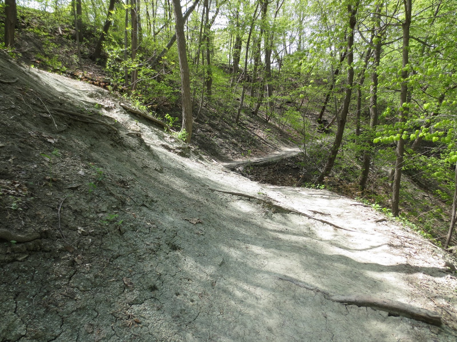
Here's the trail on the south side of the valley past the falls (which are essentially just to the right and a little below the vantage point of this photo).

Erosion may not be immediately evident if you don't have something to measure the loss of sediment, but in places with tree roots near the surface on the slopes it's easy to see how running water and gravity have done their work.

Almost a staircase of roots.

The usual array of lower Decorah fossils was present, in small chunks of rock and loose. It seemed to be a particularly good day for observing strophomenids (in the hash plates, primarily; they tend to break up otherwise). One example in the photo below is probably Rafinesquina, based on the thinness of the valve. This genus is named after Rafinesque, who we met last week and had a much more substantial career than getting into arguments about sloths. Another nice piece observed was a Bumastoides pygidium.

A. Probable Rafinesquina valve. B. Bumastoides pygidium

In one area I observed two pieces of a larger specimen of Rauffella palmipes. This is all catch-and-release, of course!

Two fragments of a large Rauffella palmipes.

Shadow Falls includes not only the falls, but a long valley oriented east-west with its head near but not quite reaching Cretin Avenue. I haven't spent much time in the valley above the falls because the area right above the falls tends to turn into a muddy swamp, but it's been a dry spring. The creek feeding the falls is in a very deep valley for its size, but would have been somewhat bigger in the days before sewers and roads.

The creek valley above Shadow Falls...

...opens up into this near its head.

There are several large fossiliferous blocks along the creek that include crinoid columnals notably larger in diameter than the run-of-the-mill lower Decorah columnals (note that the photo in the linked post is biased to larger, more photogenic columnals). The obvious guess is that they were brought to the area by glaciers and represent a different part of the stratigraphic column, say the upper Decorah or one of the overlying Ordovician formations that have been stripped from the area.

Large columnals

Sunday, February 26, 2017

Subsurface paleontology of Lafayette Square and the Washington Monument

Washington, D.C. is not generally ranked in the first order of fossiliferous areas. It can hardly be considered a bust, though. The "Middle" Cretaceous Potomac Group (due to a tragic geologic oversight, there is no formal Middle Cretaceous) has been reasonably kind for plants; see Fontaine (1889, 1896), Knowlton (1889), Ward (1895), Ward et al. (1905), and Sinnott and Bartlett (1916) for some of the gory details. Something you may notice from that list is that all of those publications are at least a century old. The obvious problem is that Washington is a city first and foremost, so it's not like there are a lot of outcrops for prospecting any more. The Potomac Group has also produced some scrappy dinosaur remains, and anywhere that the Potomac River once flowed is liable to have cobbles with Skolithos tubes, eroded from Cambrian rocks up in the mountains. The classic Potomac Skolithos cobbles are rounded pieces of orangeish quartzite with simple vertical Skolithos burrows, similar to skinny pencils and with a tendency to stand out from the host rock. Washington is also blessed with a profusion of fossiliferous building stone, particularly the inevitable "Indiana Limestone" (Salem Limestone). But I digress. In a city, we cannot come to the outcrop, so the outcrop must come to us. This is where subsurface explorations come in handy. We talked about taking cores from lake sediments a few weeks ago. The subsurface of Washington, like any major city, has been picked at innumerable times, uncovering fossils from places such as just north of the White House and near the Washington Monument.

Sunday, January 29, 2017

Kirchner Marsh and the use of lake sediments

As we've seen from time to time with packrat middens, there are many ways of looking at past ecological conditions. A common method in more humid environments that the deserts and mountains of the Southwest is studying lake deposits, which is quite well-suited to the Land of 10,000 Lakes. Many types of paleoecologically useful fossils can be extracted from lake sediments, ranging from diatoms ("algae" with silica cell walls), to spores and pollen, to mollusks, to ostracodes, to the jaw parts of certain midge larvae. (There are, of course, other kinds of fossils that can be found in lakes, but they aren't as commonly used for paleoecological work. A single mammoth, while certainly of great interest, is not as versatile for this kind of thing as innumerable pollen grains spread over thousands of years.) Spores and pollen are part of a group of fossils known as palynomorphs, organic-walled microfossils. There are several other types of palynomorphs, including various cysts and so forth, but for the purposes of upper Pleistocene and Holocene lake sediments in Minnesota, spores and pollen are clearly the stars of the show.

Saturday, November 26, 2016

Cottage Grove Ravine Regional Park: the green rocks of home

I come from Cottage Grove, Minnesota, and in the southeast part of town there's Cottage Grove Ravine Regional Park. Up until a few weeks ago, I had no idea that there was actually exposed bedrock in the park. The only outcrops I knew of in town were a couple of pockets around the compost site, a couple of spots in Old Cottage Grove, and some outcrops of the St. Peter Sandstone up high on Camel's Hump overlooking Highway 61 (there's a little park up on the crest of the hill now, with a good view across the valley, by the way). Obviously, I had to have a look around.

The rocks, counterintuitively, are the green things in this photo.

Sunday, August 2, 2015

World of Stone


This is part of Devil's Parlor in the Minnesota side of Interstate Park, on the St. Croix River. I was at the park on Saturday for a park geology program, and following work I wandered through the Glacial Gardens section. Interstate Park, as its name suggests, has units in two states, in this case Minnesota and Wisconsin. The two parts are state parks, associated with but not part of St. Croix National Scenic Riverway (the Wisconsin side is also the western trailhead for the Ice Age National Scenic Trail, as well as one of the nine parts of the Ice Age National Scientific Reserve). Interstate Park is known for its glacial landforms, imprinted primarily on Precambrian bedrock.

Saturday, March 14, 2015

Tule Springs Fossil Beds National Monument

I'm sorry about the gap there. I was traveling for work in the Southwest, and was unable to take the time to write anything. Here, though, is a piece about one of the places I saw, albeit briefly: one of the newest National Monuments, Tule Springs Fossil Beds National Monument. This site, north of Las Vegas, was declared in December 2014. It is noted for its abundant Pleistocene fossils, the depth of knowledge concerning its geologic and climatologic history, and historically notable investigations. Having just been established, there are no official National Park Service facilities quite yet.

Looking out across part of the southern end of the monument, facing north-northeast.

Sunday, November 2, 2014

Out in the fall: the southeastern metro

There is a brief period of time during the fall in the Twin Cities metro after the heat, humidity, insects, and plant growth of the summer have subsided, but before the first significant snowfall has hidden the ground. It usually starts around the middle of October and lasts until about Thanksgiving, depending on temperature and moisture. It's a great time to be outside, if you don't mind the increasing chill, and it gives you one last chance at the rocks. There's one area of bedrock outcrops on the Mississippi before we get to the confluence with the St. Croix, from about Grey Cloud Island and downstream, and we've only really stopped there once, although the rocks are covered here as well. However, there's a reason it hasn't been discussed much: there's not as much to see. If you're down in the area, though, here's the rundown:

Sunday, August 3, 2014

Where to see metro geology, part 6: odds and ends

And now, to complete, more or less, my other series:

I've already hit most of the best places to see Twin Cities bedrock geology up close, and there isn't really much need to flog this further. So, to wrap up things, I'm collecting a few stray thoughts on other areas. There is one other location that is supremely worthy of its own post, and if you are tuned in to the local fossil-hound scene you can guess exactly what it is, and also why there's not much of a point in discussing it now. Thus, the Brickyard of Lilydale will wait.

Previous entries:
Lock and Dam 1/Ford Bridge area
Minnehaha Regional Park
Coldwater Spring
Fort Snelling State Park
Shadow Falls Park

Sunday, July 27, 2014

Where to see metro geology, part 5: Shadow Falls Park

Having worked the dinosaurs out of my system for a couple of weeks at least, it is time to return to the Twin Cities. Today's location is one of my favorite places. I first visited it when I was an undergrad at the University of St. Thomas around the turn of the century. This may surprise some of you (well, if this is the first post you've read), but the non-scholastic aspects of college life were utterly lost on me. I did some writing and reading, learned how to kind of flail at a guitar in a rhythmic fashion and sing at the same time, and started the world's drabbest-looking website on dinosaurs. It's amazing how these things will occupy you. In my hectic schedule I also found time to spend poking around the network of goat trails along the Mississippi gorge, which is where the subject of this post comes in.

Sunday, May 25, 2014

Where to see metro geology, part 4: Fort Snelling State Park

It seems reasonably fitting for the Memorial Day weekend for the next stop to be at Fort Snelling State Park. Although the fort is certainly best known for its place in the history of Minnesota, it is also an early geological locality of note. Because of this, and because much of the original bedrock has been covered, this post will have a more historical bent.

Sunday, April 27, 2014

Where to see metro geology, part 3: Coldwater Spring

Picking up from where we left off last time...

Going south from Minnehaha Park on the bike trail network, specifically the Fort Snelling State Trail, we encounter Coldwater Spring. Coldwater Spring, also known as Camp Coldwater, is a small parcel situated between property of Minnehaha Park, Fort Snelling State Park, the Veterans Hospital, and other landowners (there's actually a number of small land parcels in this area, but this is a paleontology and geology blog, not a land ownership blog. If you're curious, there's a map here, with Coldwater as #8, Department of the Interior). The site is currently owned by the National Park Service as the only part of Mississippi National River and Recreation Area that is not an island. Before that, it hosted a Bureau of Mines complex. The complex was vacated during the 1990s after the bureau was closed by Congress, but the buildings still stood until 2011. In fact, if you are using the older version of Google Maps, the buildings reappear when you've zoomed in far enough to transition from flat to 45 degrees. All that's left of the complex today is a few chunks of foundation and the concrete ore storage bins. Before the Bureau of Mines, the titular spring was used by Fort Snelling, taking over what had been a squatter's camp in the 1820s and 1830s. Going back before the Fort, we get into the tribal period of use. The spring is in the Platteville Formation, which is not surprising given that the different members of the formation can promote spring outflows at the contacts (water flows through one member, then runs into another member which isn't as permeable).

Sunday, April 20, 2014

Watching the river flow

Nothing in particular, just a few observations:

I had some errands to do in St. Paul on Saturday and ended up showing my mother around some of the localities I'd been to last year for a project. There was the overlook north of the Ford Bridge, across from the Temple of Aaron, where I'd seen a shell bed in the Magnolia Member of the Platteville, but the site turned out to be a lot more interesting with a year of experience under my belt. This time, we could follow the shell bed around the outcrop, and I could pick out the overlying Carimona Member of the Decorah Shale.

The shell bed, highlighted by a helpful graffiti artist.

Sunday, April 13, 2014

Where to see metro geology, part 2: Minnehaha Regional Park

When we left off in Part 1, we were hanging around the observation area of Lock & Dam 1. Directly west of the observation area is Minnehaha Regional Park, famous as the home of Minnehaha Falls. Minnehaha Falls is one of a series of cataracts that have formed along the Mississippi in the Twin Cities. The basic processes went like this: each time the glaciers rolled through, they filled up the preexisting river system with glacial debris, and each time they retreated, the river system reestablished drainage. The last time the system was reset, the Minnesota–Mississippi network was grinding its way through the Platteville until it scoured into an old channel in the vicinity of Dayton's Bluff. It's a lot easier to wash out loose debris than it is to erode the Platteville, and a waterfall (proto-St. Anthony Falls) formed where the two met. Over the years, the waterfall eroded upriver, and every time the falls passed a tributary, a smaller waterfall ended up forming on that creek or river, too. This is how we got Hidden Falls, Shadow Falls, and a host of falls that are now mostly to well and truly extinct (human intervention in the drainage systems), as well as Minnehaha Falls. There is something of a cottage industry among Minnesota's geologists of reckoning the elapsed time since deglaciation by calculating the rate of retreat of St. Anthony Falls, using historical observations of its locations before the 1870s, the properties of the underlying formations, and the starting point, but that is for another time.

Saturday, March 29, 2014

Where to see metro geology, part 1: Lock and Dam No. 1

As the snow and ice begin to melt away and the temperature rises above freezing, it once more becomes possible to see the geology of the metro without outfitting a polar expedition. While there's something to be said for iced-over waterfalls and the peace and stillness of a fresh winterscape, it's darned hard to take field notes with choppers on or fogged-up glasses, and frankly if you're doing it to impress people, it won't work. Spring is not a bad time to do some exploring; you don't have to contend with the bugs, the generous Minnesota humidity isn't in full swing yet, and the ground vegetation hasn't obscured many areas (and given ticks places to loiter). The most obvious drawback to springtime geology is the saturation of the ground, particularly in places where the Decorah Shale is at or near the surface. The Decorah likes to form a thick gray-green mud that both cakes footwear and makes the ground admirably slippery, particularly on slopes where you'd just as soon prefer that it wasn't slippery. Throw in the leaf litter from the previous fall, and your April hike can get a lot more interesting. A less-obvious hazard is the insidious action of freeze and thaw cycles. In short, rocks that weren't fractured and liable to fall or slide in the autumn can get that way by the spring.

Sunday, December 22, 2013

Fossils from Loring Park

For the first post on something specific, I'm going a bit outside of "equatorial" and heading, instead, for approximately the end of the Pleistocene. The geologic time scale is worth a post on it own, but for now, if you're not familiar with the geologic time scale, a brief version is available through the University of California Museum of Paleontology, or you can get all the nitty-gritty from the International Committee on Stratigraphy; the ICS version is slightly more recent, so some of the dates are slightly different because they're a bit more refined. For our purposes, the Pleistocene was a time when glaciers advanced and retreated through Minnesota.

In 1923, the Northwestern National Life Insurance Company was building a new home office across from Loring Park. This building still exists, by the way (see this for its qualifications as a historic site), although the insurance company has long since moved to larger digs. During excavation, workmen cut through old moss beds and other deposits with fossils, eventually described by William S. Cooper and Helen Foot in 1932. It isn't stated, but because both authors were affiliated with the University of Minnesota, I can only guess that this is where the fossils ended up (with the exception of the snails and clams, which went to the Museum of Natural History of the University of Illinois). The following information comes from their publication, except where otherwise indicated.