Showing posts with label St. Paul. Show all posts

Tuesday, March 31, 2026

Fish Creek Canyon

You never know where interesting geology will turn up. I've been poking around the Twin Cities for years and I'm still coming across places I'd never dreamed were there. Case in point: today's pictorial topic, Fish Creek Canyon. I know the name sounds like a place you might find in Montana or Idaho, where the water is cold, the fish are biting, and the bears are waiting for you to wander away from your cooler, but this particular Fish Creek Canyon is just about where St. Paul, Maplewood, and Woodbury meet. It's not a huge canyon, and I don't imagine the fish are very large these days, but it's the kind of little hidden backyard gem that makes exploring worthwhile. I visited it with a friend back in late November, not long before our on-off winter hit the "on" switch for the first time.

Down in the valley on a great fall day, with Fish Creek in view.

Fish Creek is spread across two city jurisdictions. Maplewood has Fish Creek Natural Area, which is mostly the heights above 494 on the south and east and Highway 61 on the west. If you scout around, you'll find that this is one of a handful of small bluff-top parks between Battle Creek Regional Park and 494 overlooking 61. Adjacent on the north is the actual canyon of Fish Creek, which is within St. Paul and owned by Ramsey County Parks but apparently not organized at the moment, per se. The area is also largely within Mississippi National River and Recreation Area (so I'm also *officially* curious). The bluff-top lands are well worth walking around in their own right. There are no official access points to the canyon from the bluff-top, but it is possible to reach the canyon via social trails, leading to a steep descent into the narrow valley.

The view from the bluff, with the November afternoon sun on a clear day.

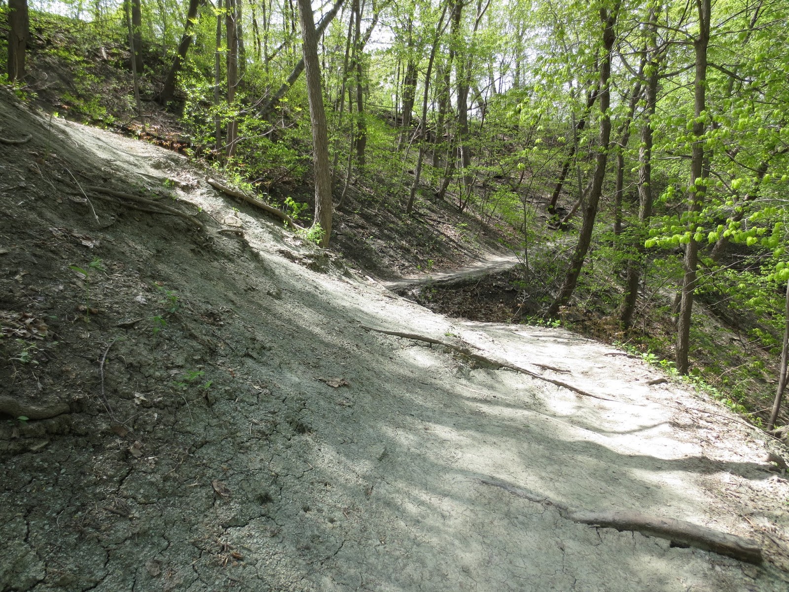
The canyon itself is not vast or deep. The water power that carved the original ravine has long since dwindled to a hoppable creek. And yet, what the creek has cut for itself is such a perfect little feature, complete with a miniature waterfall.

You're walking along, and then the creek disappears.

A miniature waterfall.

There ought to be gnomes.

It widens a bit going down (note that this feature was put in by people, presumably for water management, although it's not bad for aesthetics, either).

The rock that has been cut through here is the St. Peter Sandstone in its case-hardened form, producing the steep-sided, narrow slot. If you've driven Highway 61 near here, you may have noticed how the St. Peter sinks out of view for most of the stretch between Battle Creek and Camels Hump in Cottage Grove. It's still there, it just only shows its face sporadically, and this is the most picturesque place to find it. Interestingly, the location of Frederick Sardeson's "Highwood" collecting locality for St. Peter Sandstone fossils was supposedly a little north of here, about a mile and a half south of Battle Creek Park on 61. This works out to about the area where the ravines now occupied by Highwood Avenue and Springside Drive empty out, so our old friend was successfully trying his luck out here back in the 1890s.

Sometimes the St. Peter feels like crumbling, and sometimes it feels like holding a wall.

Sunday, February 11, 2024

Finding waterfalls

A couple of months back, a friend pointed out a news items covering a slot canyon in Crosby Farm Park, so we decided to see if we could find it. We were successful in locating what's also called Homer's Odyssey (must be a pun based on the proximity to Homer Street), and it turned out to be one of the most unusual natural features of the Twin Cities. It's certainly worth a visit the next time you're in the park, although I can imagine it could be difficult to access during a year when it rains more than once every three months or so.

Approaching the entrance.

Looking back through the slot.

Inside the feature, which is kind of like a tall roughly cylindrical void.

Looking up at the top.

The canyon is almost like someone took a knife and cut straight down. Granted, it's not as if fresh St. Peter Sandstone shows much in the way of resistance to erosion, but I do wonder if there was a pre-existing weakness that focused this erosion so narrowly. Maybe there were voids in the sandstone or something similar?

Active waterfalls, waterfalls reduced to a trickle, and former waterfalls are scattered all over the Twin Cities metro. Some former falls, like the one in Cottage Grove Ravine Park or the abandoned falls northeast of Minnehaha Falls, have been high and dry for a long time due to the loss of their water source in the mists of time, but many have lost their flow due to drainage control measures in the past 150 years or so. Some could be reanimated with different priorities, while others have been buried or destroyed.

And even the best of them sometimes get caught short in droughts, as Minnehaha Falls shows in early October 2022.

Even beyond the named falls, there are many small-scale unnamed or obscure features. If you're looking to find some for yourself, you can often guess general areas to look from topo maps: look for valleys crossing steep contours. That's a telltale sign that a creek once crossed a bluff, or something similar. Or, if you'd rather try immediate adventure, get on one of the gorge trails (e.g., the Winchell Trail in Minneapolis or the unnamed goat path equivalents on the St. Paul side) and just keep your eyes open; they're there.

The falls in the Grotto, exiting the University of St. Thomas.

This is on the Minneapolis side, just across from E 36th Street. I've never heard that this one had a name, so it may well not have been doing more than a trickle when Minneapolis was developed, but it would have been substantial at one time.

Another area is south of Minnehaha Park, in the Coldwater Spring/dog park area. There is a secluded active waterfall southeast of Coldwater that has cut a modest slot in the St. Peter; again I'm not sure if it has a widely circulating name. Novelty Falls on the bluffs north of the dog park is very difficult to notice when the falls aren't falling; observation of the bluffs suggests there are several other places that may get mini-falls if there is a lot of rain or meltwater. Marks of water erosion at the top of the bluffs and water-worn hollows at the base will show you where flow has occurred.

A close view, low and up into the chute of the Coldwater waterfall. It's rather more impressive in person, as it tends to photograph poorly due to the confines of the site and the limited foot space. (Note that this area below the bluff has a tendency to become a respectable swamp following anything stronger than a light rain.)

Novelty Falls itself wasn't running in November, but these bluffs are very interesting!

They are also present on the south side of the Mississippi; for example, the Brickyard trail in Lilydale Regional Park passes right by one:

Here pictured during one of the few days this "winter" when there was snow on the ground.

(And yes, I am well aware that this blog has never covered the Brickyard...)

Sunday, August 29, 2021

Further thoughts on the location of Finn's Glen

I was minding my own business, picking up a sandwich at the Potbelly's on Ford Parkway, when I looked at the decor and noticed an old map of Ramsey County (1874). Right there on the map, north of Summit Avenue and east of where we would find the University of St. Thomas today, is "Wm. Finn". William Finn. Finn of Finn's Glen.

Forgive the flare. It was a dramatic moment.

Bingo. Meaning what, exactly? (Unfortunately, it doesn't identify the glen.) Years ago I wrote about Finn's Glen in conjunction with Shadow Falls. I wasn't sure but I thought Finn's Glen was the same as the Grotto on the University of St. Thomas campus, south of Shadow Falls. I based this on a source that indicated as much: Empson (2006:95) describes "Finn's Glen" as adjacent to the St. Paul Seminary, south of Summit Avenue, and a place of meditation. As a University of St. Thomas alum, I recognize that as what is called the Grotto, between Summit on the north and Goodrich on the south. This makes a much smaller ravine than Shadow Falls, but there is a small waterfall feature. Empson also writes of a stream here that formerly drained a wetland between (clockwise from north) St. Clair, Snelling, Randolph, and Fairview. We can see this in Winchell's "Falls of St. Anthony" map (1877). But...

Finn's Glen is clearly marked...

...Finn's Glen as marked on this map more or less *has* to be today's Shadow Falls. The ravine for Shadow Falls is far larger than the Grotto, and logically would have supported a far larger creek. Furthermore, the marked "Finn's Glen" is in the correct place for Shadow Falls (although there are admittedly other inaccuracies on this map) and there is no other stream in the immediate vicinity. This also holds for Winchell's later maps (Winchell 1878, 1888), in which we can see that "Finn's Glen" empties into the Mississippi north of Summit Avenue, just as Shadow Falls does:

From Winchell (1878).

From Winchell (1888).

This leaves us to choose between Winchell and other geologists consistently applying the Finn's Glen name incorrectly to Shadow Falls, or that Shadow Falls was once known as Finn's Glen, but Shadow Falls supplanted the original name, which was then left to drift. Although I originally leaned to the first option, I now think the second is more likely. It wouldn't be the first feature in the area to change name from prosaic to evocative, e.g., Brown's Falls becoming Minnehaha Falls. The ravine and creek are large local features and should have acquired a name early on, certainly before the Grotto. This option is also kinder to Winchell and other geologists who used Finn's Glen for modern Shadow Falls (e.g., Sardeson and Ulrich). Does it fit with the timeline?

Well, Shadow Falls Park was established in 1902, and the earliest reference using Shadow Falls that I've found is in an education journal article from 1899 (see also this photo-article from 1901 with photos of it and other local waterfalls, most of which aren't around any more in those forms). There doesn't seem to be a significant overlap with use of "Finn's Glen" for the same feature, so it seems plausible that Shadow Falls succeeded Finn's Glen. Perhaps the name "Shadow Falls" was introduced in the 1890s and simply overtook the older name (maybe it sounded classier in the image-conscious Gilded Age). Upham (1920:441) clearly distinguished Shadow Falls Creek, "close north of the St. Paul Seminary," from Finn's Glen "about a mile farther south". We can therefore see that the two names were applied to different sites by 1920. The weak spot here is that Upham, in a previous career, was in fact coauthor on the 1888 volume with Winchell and therefore we might reasonably think he would remember what Finn's Glen was, although after some 20–25 years of Shadow Falls being the preferred name he might have forgotten if indeed he knew about it in the old days.

Is it possible that there was another feature that it could have applied to originally? Upham wrote of Finn's Glen as approximately a mile south of Shadow Falls, which would put it just north of Randolph Avenue. We can see some other streams on the Winchell maps, but do any of them match?

Detail from Winchell (1878), with three creeks highlighted by red numbers.

#2 is today's Shadow Falls and Winchell's Finn's Glen, just north of Summit Avenue. #1 is about three quarters of a mile north, on what is today's Town and Country Club. (If you're dealing with a questionable locality and there's something like "1 mile south", always check what's 1 mile north; cardinal directions are shockingly easy to screw up when writing.) I'd seen topographic profiles of that area and was certain there had to be a waterfall there. Well, there was, but it's been gone a long time. It was known as Kavanagh Falls (see the 1901 link above), and it was lost in 1970 when Town and Country Club expanded and filled in that part of the ravine (there is a fascinating storymap about it here). (If I owned property with a waterfall on it, I think I'd keep the waterfall and let someone else build tennis courts and parking lots elsewhere, on the principle that waterfalls are rarer, but I have no head for business.)

#3 is more of a mystery. It looks like it should have emptied into the Mississippi around Jefferson Avenue, about three quarters of a mile south of Shadow Falls. This is not a mile, but it's not unconscionably off, either. This one is even harder to account for than Kavanagh Falls. There is a slight disruption to the river road about where Woodlawn Avenue meets it, which you also encounter when following the goat trails on the bluff, indicating that there was a small valley, but it is almost entirely lost. Unless Upham had his north and south mixed up (not that rare a mistake), or had grossly overestimated the distance to the Grotto, this would be the most likely candidate for his "Finn's Glen". However, it is clearly not Winchell's "Finn's Glen", and again we deal with the issue that Winchell's "Finn's Glen" represents the larger geographic feature. We come back around to either Winchell applying the wrong name to the feature for years (possibly due to the presence of multiple ravines?), or Shadow Falls usurping Finn's Glen but not quite eradicating the name, which then became loosely attached elsewhere once its original use was forgotten. (Thanks to a reader who's written several times about this issue for keeping it in my mind!)

References

Empson, D. L. 2006. The street where you live: a guide to the place names of St. Paul. University of Minnesota Press, Minneapolis, Minnesota.

Upham, W. 1920. Minnesota geographic names: their origin and historic significance. Collections of the Minnesota Historical Society 17. Minnesota Historical Society, St. Paul, Minnesota.

Winchell, N. H. 1877. The geology of Hennepin County. Minnesota Geological Survey, St. Paul, Minnesota. Annual Report 5:131–201.

Winchell, N. H. 1878. The geology of Ramsey County. Minnesota Geological Survey, St. Paul, Minnesota. Annual Report 6:66–92.

Winchell, N. H. 1888. The geology of Ramsey County. Pages 345–374 in N. H. Winchell and W. Upham. The geology of Minnesota. Minnesota Geological and Natural History Survey, Final Report 2. Johnson, Smith & Harrison, state printers, Minneapolis, Minnesota.

Sunday, May 10, 2020

Revisiting Shadow Falls Park

I like to periodically recheck various sites along the Mississippi corridor, to see how the elements are treating them, if there have been any major rock falls, damage from downed trees, changes in usage, etc. One of the places I get to more frequently than others is Shadow Falls Park. It has an informal reputation for collecting and is a place with soil on steep slopes (plus access is good and I like going there).

Here's the trail on the south side of the valley past the falls (which are essentially just to the right and a little below the vantage point of this photo).

Erosion may not be immediately evident if you don't have something to measure the loss of sediment, but in places with tree roots near the surface on the slopes it's easy to see how running water and gravity have done their work.

Almost a staircase of roots.

The usual array of lower Decorah fossils was present, in small chunks of rock and loose. It seemed to be a particularly good day for observing strophomenids (in the hash plates, primarily; they tend to break up otherwise). One example in the photo below is probably Rafinesquina, based on the thinness of the valve. This genus is named after Rafinesque, who we met last week and had a much more substantial career than getting into arguments about sloths. Another nice piece observed was a Bumastoides pygidium.

A. Probable Rafinesquina valve. B. Bumastoides pygidium

In one area I observed two pieces of a larger specimen of Rauffella palmipes. This is all catch-and-release, of course!

Two fragments of a large Rauffella palmipes.

Shadow Falls includes not only the falls, but a long valley oriented east-west with its head near but not quite reaching Cretin Avenue. I haven't spent much time in the valley above the falls because the area right above the falls tends to turn into a muddy swamp, but it's been a dry spring. The creek feeding the falls is in a very deep valley for its size, but would have been somewhat bigger in the days before sewers and roads.

The creek valley above Shadow Falls...

...opens up into this near its head.

There are several large fossiliferous blocks along the creek that include crinoid columnals notably larger in diameter than the run-of-the-mill lower Decorah columnals (note that the photo in the linked post is biased to larger, more photogenic columnals). The obvious guess is that they were brought to the area by glaciers and represent a different part of the stratigraphic column, say the upper Decorah or one of the overlying Ordovician formations that have been stripped from the area.

Large columnals

Sunday, April 22, 2018

Foerstediscus splendens, a Minnesotan in Washington

Because I was in northern Virginia, I thought I'd visit the National Museum of Natural History. While nosing around the Ocean Hall, I ran into another Minnesotan: the holotype specimen of the edrioasteroid Foerstediscus splendens (Bassler 1936). I couldn't get right up to due to the glass, so the photos aren't the clearest and there's no scale, but it's still a fine specimen, and somewhat larger than I expected following my experience with the minuscule Pyrgocystis (for reference, it's described as 3 cm across, a little more than an inch).

Points to you if you too noted "Middle Ordovician"; with redefinition and redating of the Ordovician, "Late Ordovician" would be more accurate.

Here's a closer view of the specimen. "S. 4079" is the Smithsonian's number; it was originally a University of Minnesota specimen, UMPC 4742a, but it was donated to the Smithsonian (Rice 1990). From my own experience with the UMPC fossils, I think all of the edrioasteroids they had on hand by approximately the mid-1930s went to the Smithsonian at Bassler's request, with the specimens I photographed coming with Sardeson's collections a few years later.

"Edrioasteroid" means "seated star", which is reasonably self-explanatory.

Edrioasteroids are among the rarest fossils from the Decorah and Platteville formations of Minnesota, with their other competition in that category being other echinoderms such as sea stars and cystoids. Seeing as how these fossils are very rare here except in certain places such as the former Johnson Street Quarry, the obvious scenario is that non-crinoid echinoderms only thrived under certain conditions that are poorly represented in the known outcrops of the Platteville and Decorah. (Alternatively, they *were* more common than we know, but they decomposed so completely to their constituent plates that they've been unrecognizable; be that as it may, though, the Platteville/Decorah echinoderm diversity doesn't seem to be as high as in other formations of similar age in the central US.)

Foerstediscus splendens was collected from the Ford Plant (Bassler 1936). Work on the Ford Plant, Ford Bridge, and Ford Dam (Lock and Dam No. 1) in the 1920s made that area a great place for collecting, as discussed in this post. Clinton R. Stauffer named 56 species of microfossils from collections at the bridge (Stauffer 1933, 1935), and August Foerste named the nautiloid Metaspyroceras perlineatum (Foerste 1932) from the vicinity of the plant and dam. F. splendens was found by Irving G. Reimana from the top of the Rhinidictya bed of the Decorah Shale (Bassler 1936), otherwise known as Bed 4 (Sloan 1987), or, a little more informally, the lower third of the Decorah Shale above the Carimona Member. (One of these days I ought to outline the bed divisions.) In more practical terms, Bed 4 is the Decorah you see at Shadow Falls, so the top of Bed 4 would be somewhere at or a little higher than the highest part of the ravine. Strangely, Stauffer and Thiel (1941) attributed Foerstediscus to the underlying Carimona Member, or Bed 3, despite Stauffer presumably being the one who gave Bassler the stratigraphic information in the first place.

Looking east from Minnehaha Park in June 2013, toward the defunct Ford Plant (across Lock and Dam No. 1, aka the Ford Dam).

The closure and dismantling of the Ford Plant over the past few years provide an unusual opportunity to look at current events in a geological frame of mind. The Ford Plant was a fixture of southwestern St. Paul for decades (and it happened to be there because there was a young river gorge carved by a post-glacial waterfall that could be harnessed for hydroelectric power, and because there was once a pure sandy beach that could be turned into auto glass). Its day is now over, though, and soon its former grounds will be rebuilt into something entirely different. Ten thousand years ago, mammoths and giant beavers roamed its grounds. Seventy million years ago it was probably a coastal plain near a sea filled with ammonites and marine reptiles. 454 million years ago edrioasteroids, nautiloids, and other marine invertebrates lived and died in a shallow tropical sea that had submerged the pure sandy beach. Underneath all of it are volcanic rocks more than a billion years old that fill a scar from Michigan to Kansas. Every part of history is made up of what came before it, and shapes what comes after it.

References

Bassler, R. S. 1936. New species of American Edrioasteroidea. Smithsonian Miscellaneous Collections 95(6).

Foerste, A. F. 1932. Black River and other cephalopods from Minnesota, Wisconsin, Michigan and Ontario (Part 1). Denison University Scientific Laboratories Journal 27:47–137.

Rice, W. F. 1990. Catalog of paleontological type specimens in the Geological Museum, University of Minnesota. Minnesota Geological Survey, St. Paul, Minnesota. Information Circular 33.

Sloan, R. E. 1987. History of study of the Middle and Late Ordovician rocks of the Upper Mississippi Valley. Pages 3–6 in R. E. Sloan, editor. Middle and Late Ordovician lithostratigraphy and biostratigraphy of the Upper Mississippi Valley. Minnesota Geological Survey, St. Paul, Minnesota. Report of Investigations 35.

Stauffer, C. R. 1933. Middle Ordovician Polychaeta from Minnesota. Geological Society of America Bulletin 44(6):1173–1218.

Stauffer, C. R. 1935. The conodont fauna of the Decorah Shale (Ordovician). Journal of Paleontology 9(7):596–620.

Stauffer, C. R., and G. A. Thiel. 1941. The Paleozoic and related rocks of southeastern Minnesota. Minnesota Geological Survey, St. Paul, Minnesota. Bulletin 29.

Sunday, July 31, 2016

(former) Ash beds in St. Paul

Although many Minnesotans are aware of the great Midcontinent Rift that runs across the state, it's less generally well-known that evidence of some of the largest known volcanic eruptions in the history of the planet can be found in the Twin Cities. In fact, you can easily put your hand on a layer of former volcanic ash by taking a short walk at our old friend Shadow Falls Park, at the end of Summit Avenue.

Thursday, March 24, 2016

Mostly bryos and burrows

It's still a little early to be out and about in the metro rocks and expect good luck (for one thing, the Decorah is still in winter-spring-transition mud mode) or consistent weather, but we're getting close, and sooner than usual. Here's one seasonal photo and then a few interesting pieces I hadn't featured before. These are all photos of Decorah Shale fossils from the St. Paul side of the river.

Lower Decorah a couple of weeks ago, after having been relatively warm and dry for several days. These two fragments were covered with half-burrows (imagine a tubular burrow split along its long axis), and several other pieces from the same area and probably a similar stratigraphic level had the same kind of abundant half-burrows.

Sunday, February 8, 2015

Historic Twin Cities geologic maps and photos

I've been a bit busy lately, so no full post, but here are some historical geologic images and maps of the Twin Cities, 1877–1941. Enjoy!

A map of the surficial geology of Minneapolis and western St. Paul, from Winchell (1877). Note "Finn's Glen" at the end of Summit Avenue, today's Shadow Falls. Also note Bassett's Creek in Minneapolis, once a major waterway but now built over. Some now-defunct quarries and waterfalls are also marked. As far as I know, this and the other maps included here are the oldest published geologic maps for their respective areas.

Small quarries of Platteville stone once dotted the Twin Cities. This is a fairly late example, pictured in Sardeson (1916). Kansan till refers to a now-obsolete system of glacial episodes

Sunday, August 3, 2014

Where to see metro geology, part 6: odds and ends

And now, to complete, more or less, my other series:

I've already hit most of the best places to see Twin Cities bedrock geology up close, and there isn't really much need to flog this further. So, to wrap up things, I'm collecting a few stray thoughts on other areas. There is one other location that is supremely worthy of its own post, and if you are tuned in to the local fossil-hound scene you can guess exactly what it is, and also why there's not much of a point in discussing it now. Thus, the Brickyard of Lilydale will wait.

Previous entries:
Lock and Dam 1/Ford Bridge area
Minnehaha Regional Park
Coldwater Spring
Fort Snelling State Park
Shadow Falls Park

Sunday, July 27, 2014

Where to see metro geology, part 5: Shadow Falls Park

Having worked the dinosaurs out of my system for a couple of weeks at least, it is time to return to the Twin Cities. Today's location is one of my favorite places. I first visited it when I was an undergrad at the University of St. Thomas around the turn of the century. This may surprise some of you (well, if this is the first post you've read), but the non-scholastic aspects of college life were utterly lost on me. I did some writing and reading, learned how to kind of flail at a guitar in a rhythmic fashion and sing at the same time, and started the world's drabbest-looking website on dinosaurs. It's amazing how these things will occupy you. In my hectic schedule I also found time to spend poking around the network of goat trails along the Mississippi gorge, which is where the subject of this post comes in.

Sunday, April 20, 2014

Watching the river flow

Nothing in particular, just a few observations:

I had some errands to do in St. Paul on Saturday and ended up showing my mother around some of the localities I'd been to last year for a project. There was the overlook north of the Ford Bridge, across from the Temple of Aaron, where I'd seen a shell bed in the Magnolia Member of the Platteville, but the site turned out to be a lot more interesting with a year of experience under my belt. This time, we could follow the shell bed around the outcrop, and I could pick out the overlying Carimona Member of the Decorah Shale.

The shell bed, highlighted by a helpful graffiti artist.

Saturday, March 29, 2014

Where to see metro geology, part 1: Lock and Dam No. 1

As the snow and ice begin to melt away and the temperature rises above freezing, it once more becomes possible to see the geology of the metro without outfitting a polar expedition. While there's something to be said for iced-over waterfalls and the peace and stillness of a fresh winterscape, it's darned hard to take field notes with choppers on or fogged-up glasses, and frankly if you're doing it to impress people, it won't work. Spring is not a bad time to do some exploring; you don't have to contend with the bugs, the generous Minnesota humidity isn't in full swing yet, and the ground vegetation hasn't obscured many areas (and given ticks places to loiter). The most obvious drawback to springtime geology is the saturation of the ground, particularly in places where the Decorah Shale is at or near the surface. The Decorah likes to form a thick gray-green mud that both cakes footwear and makes the ground admirably slippery, particularly on slopes where you'd just as soon prefer that it wasn't slippery. Throw in the leaf litter from the previous fall, and your April hike can get a lot more interesting. A less-obvious hazard is the insidious action of freeze and thaw cycles. In short, rocks that weren't fractured and liable to fall or slide in the autumn can get that way by the spring.

Sunday, February 23, 2014

A road where the buffalo roamed

Personally, I don't have fond thoughts of I-35E. In my mind, it is indelibly associated with long back-ups at the interchange with I-94 in St. Paul, particularly I-94 eastbound in the evening rush hour. But enough of complaints; if the interstate could think and speak, doubtless it wouldn't be happy with traffic jams either. I-35E happens to run in an old river valley north of I-94. The drainage was known as Trout Brook, and it gradually disappeared from the surface between about the 1880s and the 1950s (an overview of the valley can be found here).

Saturday, January 25, 2014

Platteville follies: a crushed giant rodent from Hidden Falls

I'd like to start off with a couple of photographs, to illustrate some facts of life concerning our old friend, the Platteville Formation:

An ever-so-slightly hazardous ledge along the road into Crosby Farm Regional Park.

Hidden Falls Regional Park: when good rocks go bad.
The Platteville Formation just loves to ledge out, particularly the lower part, which rests on the recessive Glenwood Formation, and once you get heavy rocks ledged out far enough... About ten thousand years ago, not very far from the second photo, there was a ledge of the Platteville Formation left jutting out in the figurative "wake" of the erosion of the Mississippi River system. At some point, a dog-sized rodent opted to go underneath it. Maybe this was its usual shelter, or maybe it was driven there by some circumstance; we'll never know, short of time travel. Unfortunately for the rodent, the slab failed, with predictable results. It would be covered by the debris until July of 1938, when a Works Progress Administration crew uncovered the site while widening what is now the north entrance road into Hidden Falls Park. Its skeleton, crushed and coated with calcite leached out of the slab, was recovered and eventually prepared, reconstructed, put on display at the Science Museum of Minnesota, and described scientifically as an example of the extinct mammal known as Castoroides ohioensis, a.k.a. the giant beaver.

From Powell (1948): the WPA project that led to the discovery (site with the superimposed white circled cross).
"Well," you say, "that was refreshingly concise." Ah, but there's always more to say.

Sunday, January 19, 2014

Divisions of the Platteville Formation

There comes a time when we must speak of the Platteville Formation in detail. If there wasn't a Platteville Formation, there would be no narrow gorge in the Twin Cities, no Minnehaha Falls or Hidden Falls, and most importantly no Saint Anthony Falls: if there's no Saint Anthony Falls, Minneapolis develops in a radically different way. No falls, no easy water power, no mills. The Twin Cities owe their existence to a 455 million year old carbonate bank and the vagaries of glacial and river erosion.

And today the Falls of St. Anthony are mostly artificial. Turns out that drilling holes through the Platteville into the St. Peter Sandstone near the edge of a cataract can be unsafe.